To provide clients with exactly what they need, when they need it
Grantham Coates Surveys is a company comprised of skilled and experienced rail, land, building, river, and engineering surveyors. We are based in the West Midlands, within easy reach of the M5, M42, and M40 motorways, making us well-placed for convenient access across the country. Our professional surveyors have carried out projects both nationally and internationally, including laser scanning of historic buildings in various European countries.
At Grantham Coates Surveys, we pride ourselves on our customer-focused approach, ensuring that each client receives the highest quality product tailored to their specific needs. Our dedicated team of surveyors is committed to providing a value-for-money service and is known for their professionalism, attention to detail, and timely delivery. Our company is a member of both the Chartered Institution of Civil Engineering Surveyors and The Survey Association, further highlighting our commitment to providing excellent service and high-quality data.
Our Services
Grantham Coates Surveys offers a comprehensive range of land, rail, river, engineering, and measured building surveying services. Our skilled surveyors have extensive experience in carrying out a wide variety of survey tasks, including:
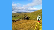
1. Topographical Surveys: These surveys capture both natural and man-made features within a given area, providing valuable spatial information for various applications, such as planning, design, and construction projects.
2. Railway Surveys: Our rail survey services cater to the specific needs of railway infrastructure, ensuring accurate data collection for design, construction, and maintenance projects.
3. River Surveys: Our river survey services provide essential data for waterway management, flood modelling, and environmental monitoring.
4. Measured Building Surveys: These surveys capture detailed information about buildings, including floor plans, elevations, and cross-sections. This data is invaluable for architectural, construction, and facilities management purposes.
5. Drone Surveys: Utilizing the latest drone technology, our surveyors capture high-resolution imagery and accurate topographical data from unique perspectives, enabling efficient data collection for various applications.
6. Laser Scanning Surveys: Our laser scanning services provide highly precise and detailed 3D point cloud data of buildings, infrastructure, and landscapes. This data is essential for a wide range of applications, such as heritage preservation, architectural design, and engineering analysis.
7. Sub-Station Surveys: Our sub-station survey services cater specifically to the needs of electrical power distribution infrastructure, ensuring accurate and reliable data for design, construction, and maintenance projects.
Regardless of the spatial information you require, Grantham Coates Surveys is dedicated to providing high-quality survey data tailored to meet your needs.

Be the first to review Grantham Coates Surveys Limited.
Write a Review


