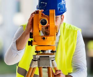
Caintech Ltd, based in Inverness, the heart of the Scottish Highlands, are specialist Land and Spatial Surveyors and Construction Setting Out engineers. Established in 1989, they initially worked within the offshore Oil sector before expanding into Construction, Land, and Hydrographic surveying in 2005. Their team uses state-of-the-art equipment from Topcon, Trimble, Leica, Norbit, Ohmex, DJI, and Sensefly, ensuring reliability and minimal downtime. They are involved in various aspects of the engineering industry, including laser scanning, construction setting out, civil engineering design, hydrographic surveys, aerial surveys, topographical surveys, boundary surveys, volumetric surveys, and UAS data capture.
 Are you a homeowner or developer in Highland seeking a trusted surveyor? Our service matches you with the most skilled professionals, offering a range of services including new-build snagging, boundary disputes, and insurance reinstatement valuations.

